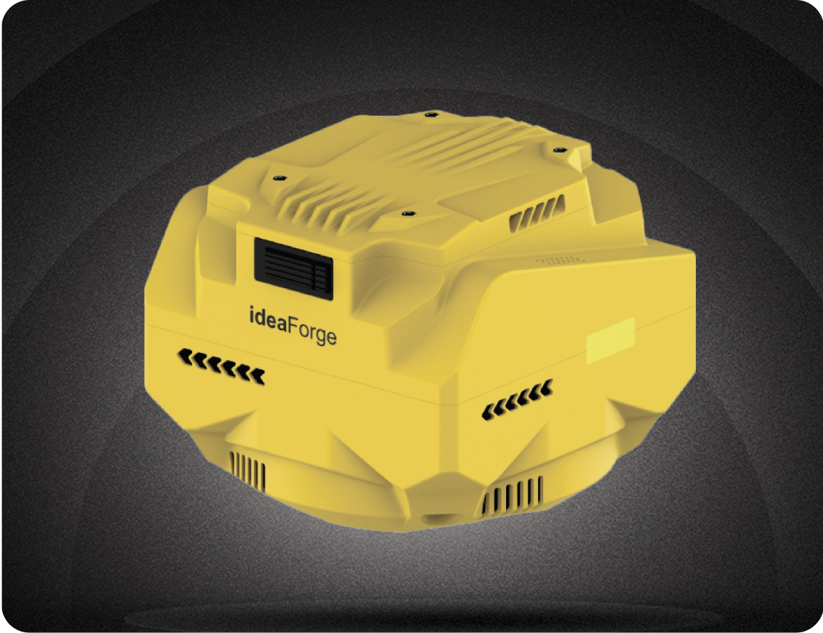
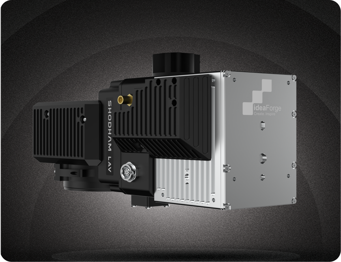
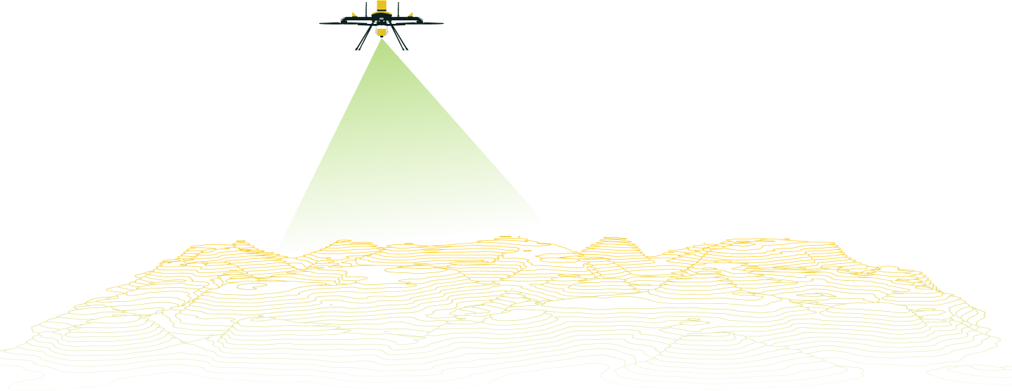
Q6 V2 GEO

Map Where Others Can’t

Built for professionals who rely on precision, it’s designed to work where the job gets tough — in remote hills, crowded cities, or long stretches of infrastructure. Whether you're running a LiDAR survey in rough landscapes or mapping dense urban grids, the Q6 V2 GEO is made to adapt. With flexible payloads, long flight times, and survey-grade accuracy, it’s not just about flying — it’s about getting the data you need, the way you need it. When you're up against tight timelines and challenging sites, it delivers the data you need — reliably, consistently, and without fuss.

The Mapping Multi-Tasker
Built for Extremes

From rugged hills to dense cityscapes, the Q6 V2 GEO is built to deliver when precision matters most. With flexible payload options, enterprise-ready intelligence, and all-terrain readiness, it’s more than just a drone — it’s your advantage in the sky.

01

Ready for Extreme
Environments

Operates in harsh conditions — from -20°C cold to +50°C heat, and in locations with limited take-off space.

02

All-Terrain
Performance

Performs with precision across rugged terrain, steep gradients, and uneven ground—delivering consistent results where others can’t.

03

Built to Last

Industrial-grade construction with IP-rated components ensures durability across demanding missions.

04

Performance
You Can Rely On

From mission planning to data delivery, the Q6 V2 GEO ensures fast, accurate results with the reliability to power through demanding field operations—day after day.

05

Payload Versatility That Works the Way You Do

No two missions are the same — and your drone shouldn’t be either. The Q6 V2 GEO supports a range of swappable payloads that can be configured quickly in the field, so you’re always prepared for the task ahead. From detailed mapping to inspection and monitoring, it’s a flexible, future-ready platform that does more — with just one airframe.

Ready for What’s Next

Q6 V2 GEO isn’t just built for today’s missions — it’s designed to stay relevant as your needs evolve. With support for multi-sensor setups and new payloads on the horizon, it’s a platform that keeps expanding its capabilities, so you don’t need to reinvest every time the mission changes.

Proven in the Toughest Conditions

From Himalayan glaciers to Ladakh’s cold deserts, ancient petroglyphs to rural development zones — Q6 V2 GEO has flown over 2,000 missions in demanding environments. Built for real-world work, backed by secure cloud support and dependable service that keeps you mission-ready.

Purpose-Built for
Real-World Missions

Q6 V2 GEO isn’t just made for mapping — it’s built to take on high-stakes missions in some of the country’s most demanding environments. Whether it’s conservation, research, or rural planning, it’s the drone of choice when precision matters.

Glacier & Avalanche Mapping

Deployed in the Himalayas to map glacial terrain for avalanche risk assessment and early warning studies.


Petroglyph Preservation


People Detection and Counting


Rural Varanasi Digitization


River Basin Conservation


A Seamless Ecosystem:
From Data to Decision

Flyght Cloud

From Flight to Insight—Seamlessly

FLYGHT CLOUD is ideaForge’s integrated drone data platform—designed to simplify, secure, and scale every part of your aerial workflow. From mission video to processed outputs, everything is managed in one intuitive system built for professionals.

Flyght Cloud

Smarter Missions. Right from the Field.

BlueFire Touch is ideaForge’s advanced ground control system designed for intuitive, high-precision field operations. Built for autonomy, scalability, and terrain awareness, it empowers teams to plan and execute complex drone missions with confidence—even in demanding environments.

Do More with Every Mission

Use Cases

Reliability Without Compromise

When the mission matters, so does trust in your equipment. Q6 V2 GEO is built to keep flying, keep recording, and keep your data safe — even when conditions aren’t ideal. With hardware resilience, flight redundancies, and intelligent safety protocols, it delivers operational continuity where it counts.

Power That
Keeps Up With You

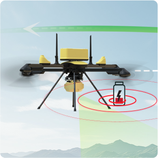
Q6 V2 GEO’s battery system is built for field performance — easy to swap, quick to charge, and tough enough for demanding missions.

Hot-swappable batteries keep you flying with minimal downtime

Fast charging support for quick top-ups between sorties

Request a
Demo

World’s most versatile
survey-grade UAV from ideaForge

Q6 V2
GEO

Trinity Pro
(White/Grey FW VTOL)

WingtraRAY
(Orange FW VTOL)

End-to-end solutioning Hardware+Software Solution
with 3rd party software integration

Yes, limited
Flying in Tough Terrain & Environment Take-Off and flying in narrow valleys
ADR assisted mapping where line-of-sight is obstructed
Operating temperature upto 50 deg C
Take-Off in 10 m/s wind
Flexible flight planning Flying slower (at 5m/s) to increase point density of LiDAR in vegetated areas
Flying lower at AGL (e.g.< 40m) with custom DEM to increase resolution
Deployment in Mapping, Security & Inspection projects Mapping and Video Payloads Compatible
Wide Variety of Payload Options Multiple LiDAR sensor options
Oblique payload integrated with IMU
Payload Development Kit

FAQs